 SHANGRALA'S
ARROWS
ACROSS
AMERICA!

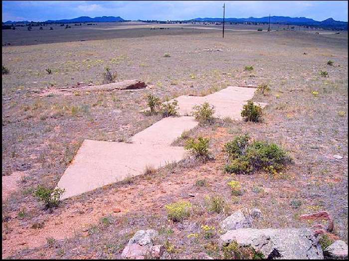
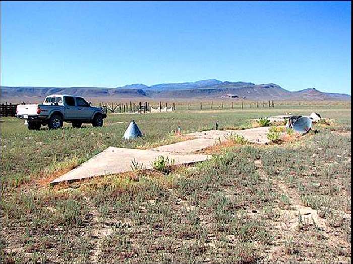
Every so often, usually in the vast deserts of the American Southwest, a hiker
or a backpacker will run across something puzzling: a large concrete arrow,
as much as seventy feet in length, sitting in the middle of scrub-covered nowhere.
What are these giant arrows? Some kind of surveying mark?
Landing beacons for flying saucers? Earth's turn signals?
No, It's ... The Transcontinental Air Mail Route!
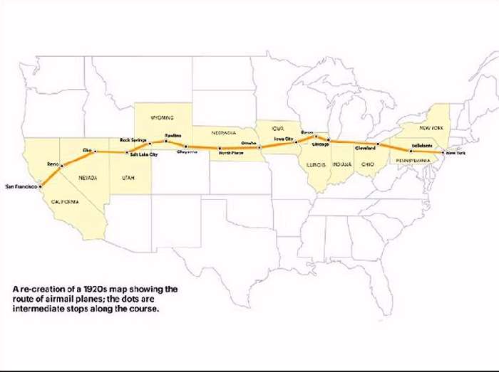
On August 20, 1920, the United States opened its first coast-to-coast airmail delivery route,
just 60 years after the Pony Express closed up shop.
There were no good aviation charts in those days, so pilots had to eyeball their way across
the country using landmarks. This meant that flying in bad weather was difficult, and night
flying was just about impossible.
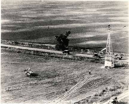
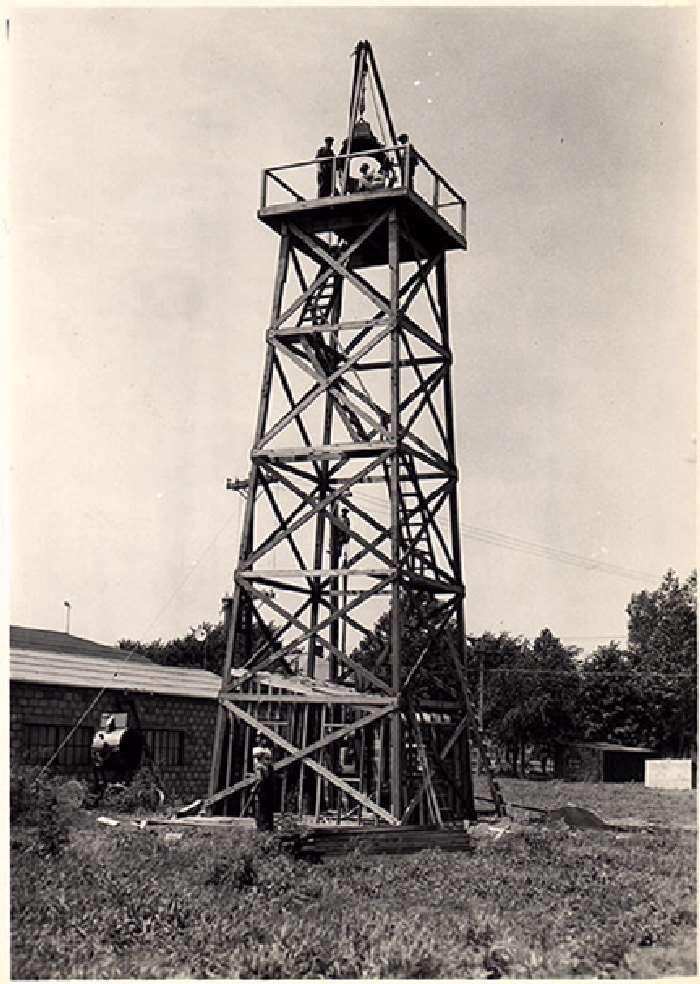
The Postal Service solved the problem with the world's first ground-based civilian navigation
system: a series of lit beacons that would extend from New York to San Francisco . Every ten
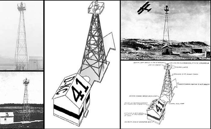
miles, pilots would pass a bright yellow concrete arrow. Each arrow would be surmounted by
a 51-foot steel tower and lit by a million-candlepower rotating beacon. (A generator shed at
the tail of each arrow powered the beacon.)
|
Now mail could get from the Atlantic to the Pacific not in a matter of weeks, but in just 30
hours or so.
Even the dumbest of air mail pilots, it seems, could follow a series of bright
yellow arrows straight out of a Tex Avery cartoon. By 1924, just a year after
Congress funded it, the line of giant concrete markers stretched from Rock Springs,
Wyoming to Cleveland, Ohio. The next summer, it reached all the way to New York,
and by 1929 it spanned the continent uninterrupted, the envy of postal systems
worldwide.
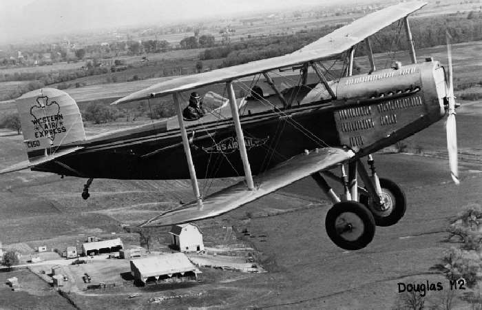
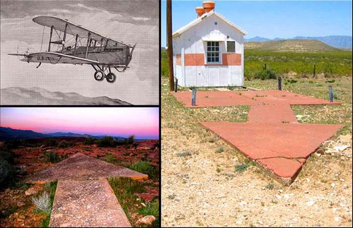
Here a restored Western Airlines Douglas M2 airplane like those that flew on
the route above where air beacons were used is shown in this 1970s photo.
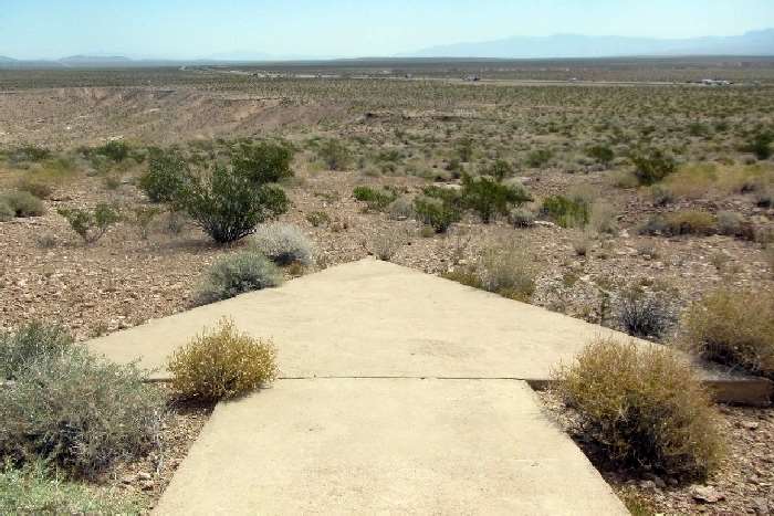
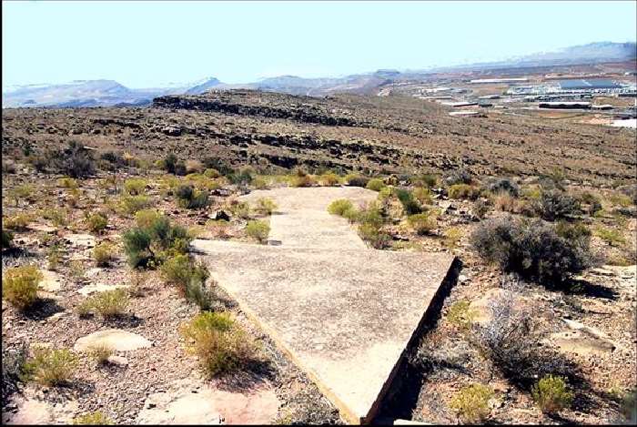
Here a concrete arrow roughly 50 feet long points to Interstate 15
from a hillside about 55 miles northeast of Las Vegas.
The arrow is a 1920s remnant of a federal program that built
rows of light towers to guide pilots at night along the earliest
airmail routes.
An Airmail navigation station of the 1930s. Radio and radar are, of course,
infinitely less cool than a concrete Yellow Brick Road from sea to shining sea,
but I think we all know how this story ends. New advances in communication and
navigation technology made the big arrows obsolete, and the Commerce Department
decommissioned the beacons in the 1940s. The steel towers were torn down and
went to the war effort.
But the hundreds of arrows remain. Their yellow paint is gone, their concrete cracks a little
more with every winter frost, and no one crosses their path much, except for coyotes and
tumbleweeds.
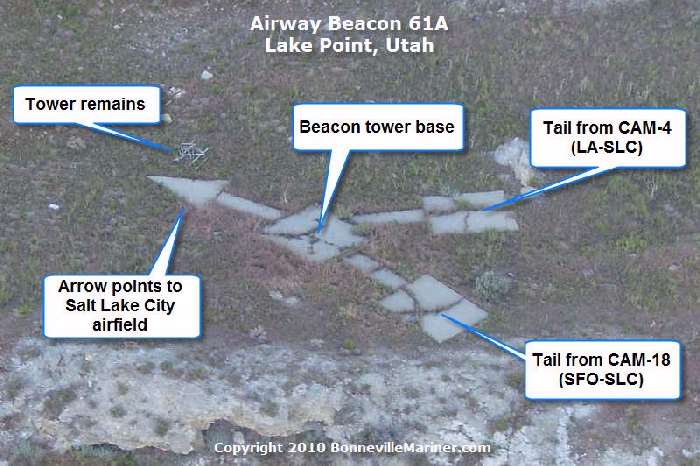
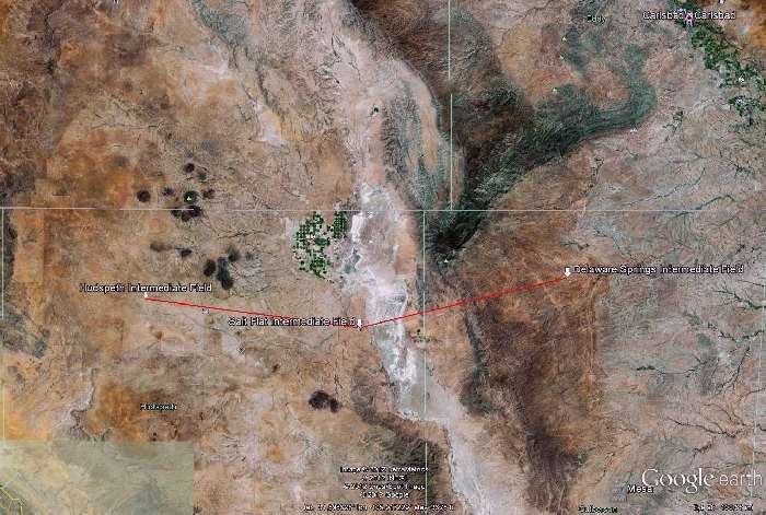
View from Google Earth Arrows Map - Yes, they're still out there, pointing the way. [Click photo for larger view.]
|

Be Sure To Share This
With All Your Friends! :)


^BACK To TOP^
For those of you who Want More FUN - Visit The Shangy Fun List! Variety is the
spice of life! The Shangy Fun List is an ezine packed full of Poems, Inspirational and
Heart Warming Stories. Jokes from G to slightly R, and Anything else that just
might make you SMILE! Join In The Free FUN!! ... :)
Yes! Click Here To GO TO THE ARCHIVES!-
Like This Page?
If you are looking for more, here are some good places to start:

Angel Falls!-
Moses Bridge!-
Fighter Aircraft!-
Auto MotorPlex!-
Liberty Air Show!-
Angel Wing Decoys!-
Beautiful Bridges 2!-
Venice Winter Flood!-
Cano Cristales River!-
Undersea Restaurant!-
Guoliang Tunnel Road!-
World's Largest Mirror!-
World's Unusual Tunnels!-
Madeira Funchal Airport!-
Amazing Gibraltar Airport!-
Underwater River In Mexico!-
Montreal Mosaicultures Show!-
Amazing Street-Legal Airplane!-
A-Z Animated Picture Images!-


 -To SHANGRALA-
SPECIAL THANKS Goes To LOUISE AUSTIN For Sharing This With Us.

Copyright © 1996 Netscape Communications Corporation. Mozilla is
a trademark of Netscape Communications Corporation.
Note: This is an Unofficial God, Jesus Christ, Family, & Cartoon Fan Site.
© All graphics representing Disney characters are copyrighted by Disney.
Likewise all other graphics & music Copyright © by their own Individual Artists.
I do not own any graphics on this site. If you do, please notify me
and I'll give
you proper credit, a link, or remove it immediately according to your wishes.
~*~ Copyright © 1997-2013 Elrhea M. Bigham ~*~
